Eastfield Crossing
Introduction
The photograph on this page of Eastfield Crossing by Raymond Okonski as part of the Geograph project.
The Geograph project started in 2005 with the aim of publishing, organising and preserving representative images for every square kilometre of Great Britain, Ireland and the Isle of Man.

There are currently over 7.5m images from over 14,400 individuals and you can help contribute to the project by visiting https://www.geograph.org.uk
Eastfield Crossing
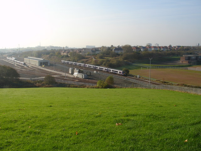
Image: © Raymond Okonski Taken: 23 Oct 2007
The train seen heading north (towards camera) has just left Glasgow Queen Street Station and is heading for Edinburgh. It is just possible to discern a high embankment beside the third coach of this six-car train. This was the former Lanarkshire and Dunbartonshire Railway route between Maryhill to Springburn Park (Robroyston), and crossed over the Queen Street main line by a double-arched bridge at what was once Eastfield MPD (Motive Power Depot). The section here - to Possil Junction and Possil Station was a goods only line, as Possil Station was the terminus for passenger services arriving from Maryhill and Glasgow. When the line closed the bridge was eventually demolished, with only the brick supports visible either side of the main line. However recent developments at Eastfield sidings to improve vehicular access resulted in these remnants being removed and the raised embankment to the east (left of picture) being cut back further. The tree on the left shows the end of the embankment. Originally Eastfield MPD was opened for business by the North British Railway in 1904 (this became LNER after the 1921 reorganisation). The depot was eventually closed for good in 1992 and the site cleared. Scotrail subsequently decided to use the site for the construction of new maintenance sheds and a train-wash facility, and was finally reopened in 2004 complete with a simplified track layout.
Images are licensed for reuse under creativecommons.org/licenses/by-sa/2.0
Image Location
Latitude
55.891742
Longitude
-4.239893