Westcliff-on-Sea : Crowstone House
Introduction
The photograph on this page of Westcliff-on-Sea : Crowstone House by Jim Osley as part of the Geograph project.
The Geograph project started in 2005 with the aim of publishing, organising and preserving representative images for every square kilometre of Great Britain, Ireland and the Isle of Man.

There are currently over 7.5m images from over 14,400 individuals and you can help contribute to the project by visiting https://www.geograph.org.uk
Westcliff-on-Sea : Crowstone House
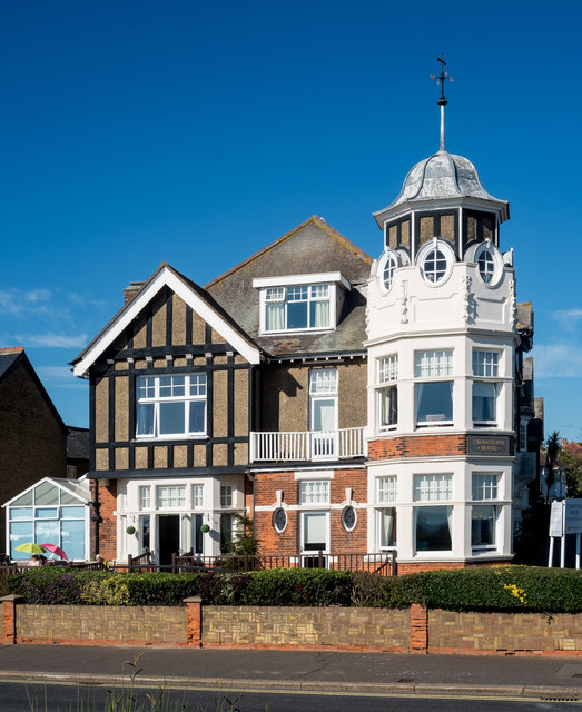
Image: © Jim Osley Taken: 27 Sep 2018
"Crowstone House, the most prominent building in the [Crowstone] conservation area was built in 1905 as a house but it was subsequently extended and converted to a ladies school by a Miss O’Meara in 1913. It is now a care home." Quoted from this https://www.southend.gov.uk/info/200422/conservation_areas/401/crowstone_conservation_area.
Images are licensed for reuse under creativecommons.org/licenses/by-sa/2.0
Image Location
Latitude
51.536401
Longitude
0.680653