St Mary, High Bickington
Introduction
The photograph on this page of St Mary, High Bickington by Chris Brown as part of the Geograph project.
The Geograph project started in 2005 with the aim of publishing, organising and preserving representative images for every square kilometre of Great Britain, Ireland and the Isle of Man.

There are currently over 7.5m images from over 14,400 individuals and you can help contribute to the project by visiting https://www.geograph.org.uk
St Mary, High Bickington
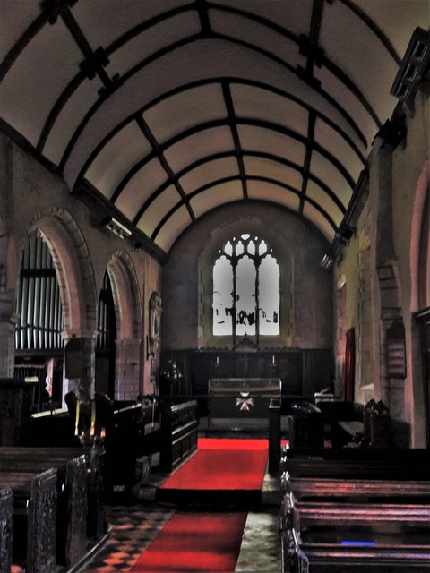
Image: © Chris Brown Taken: 28 Sep 2018
Typically for Devon and Cornwall, there is no chancel arch. Here the rood screen that church builders relied on to distinguish nave from chancel has been removed, leaving the asymmetrical tympanum created by the different roof pitches and a slight setback in the south wall.
Images are licensed for reuse under creativecommons.org/licenses/by-sa/2.0
Image Location
Latitude
50.96702
Longitude
-3.99629