Path to the River Leven
Introduction
The photograph on this page of Path to the River Leven by Lairich Rig as part of the Geograph project.
The Geograph project started in 2005 with the aim of publishing, organising and preserving representative images for every square kilometre of Great Britain, Ireland and the Isle of Man.

There are currently over 7.5m images from over 14,400 individuals and you can help contribute to the project by visiting https://www.geograph.org.uk
Path to the River Leven
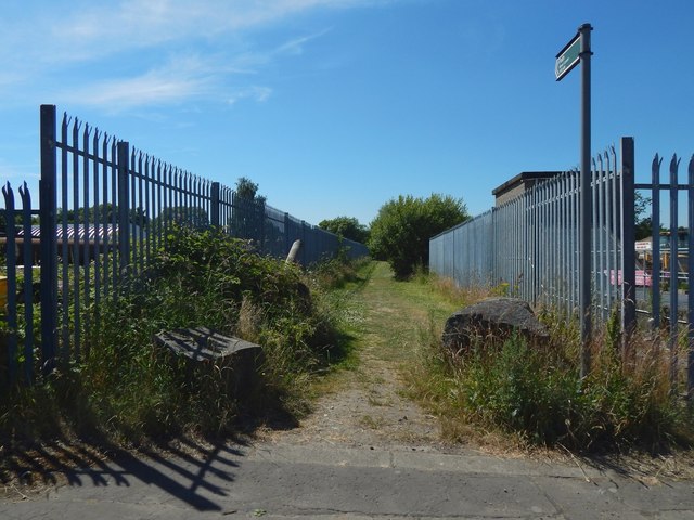
Image: © Lairich Rig Taken: 1 Jul 2018
The sign on the right reads "Path / River Leven / 100 yards". The structure behind the fence on the right is Image The path is the "CP 157" mentioned in the first of the end-notes. It is at the western end of Image; in that picture, it is at the far end of the pavement on the left. See Image for the other end of this short path, where it meets a longer path along the eastern bank of the River Leven.
Images are licensed for reuse under creativecommons.org/licenses/by-sa/2.0
Image Location
Latitude
55.948601
Longitude
-4.572656