Troedrhiwfuwch War Memorial
Introduction
The photograph on this page of Troedrhiwfuwch War Memorial by Jaggery as part of the Geograph project.
The Geograph project started in 2005 with the aim of publishing, organising and preserving representative images for every square kilometre of Great Britain, Ireland and the Isle of Man.

There are currently over 7.5m images from over 14,400 individuals and you can help contribute to the project by visiting https://www.geograph.org.uk
Troedrhiwfuwch War Memorial
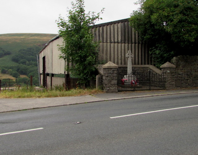
Image: © Jaggery Taken: 27 Jul 2018
Viewed across the A469. https://www.geograph.org.uk/photo/5918363 to a closer view. Located between Pontlottyn and New Tredegar, the once thriving mining village of Troedrhiwfuwch was gradually abandoned in the late 20th century as a shifting hillside to its west threatened to engulf the village. Most of the village's houses were demolished by the 1980s.
Images are licensed for reuse under creativecommons.org/licenses/by-sa/2.0
Image Location
Latitude
51.73262
Longitude
-3.260749