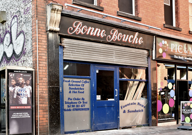
Former "Bonne Bouche", Belfast (September 2018)
Introduction
The photograph on this page of Former "Bonne Bouche", Belfast (September 2018) by Albert Bridge as part of the Geograph project.
The Geograph project started in 2005 with the aim of publishing, organising and preserving representative images for every square kilometre of Great Britain, Ireland and the Isle of Man.
There are currently over 7.5m images from over 14,400 individuals and you can help contribute to the project by visiting https://www.geograph.org.uk

Image: © Albert Bridge Taken: 24 Sep 2018
The “Bonne Bouche” was a café and bakery trading from the 1930’s to the 1970’s, originally at no 7 and later no 19 Fountain Street. This exceptionally well-preserved hand-painted sign, previously hidden, is now on temporary view, during conversion work. The following planning permission (1 August 2018) applies “LA04/2018/0420/F Change of use of ground floor to café/bar preparing and serving hot food with late licence, new glazed shopfront and relocation of entrance to gable end. Internal reconfiguration of the first floor including installation of new staircase for access by patrons to the ground floor at number 19 and to act as a means of escape. 19 Fountain Street Belfast BT1 5EA”. For something similar see Image

