Bridge of Alltglander
Introduction
The photograph on this page of Bridge of Alltglander by valenta as part of the Geograph project.
The Geograph project started in 2005 with the aim of publishing, organising and preserving representative images for every square kilometre of Great Britain, Ireland and the Isle of Man.

There are currently over 7.5m images from over 14,400 individuals and you can help contribute to the project by visiting https://www.geograph.org.uk
Bridge of Alltglander
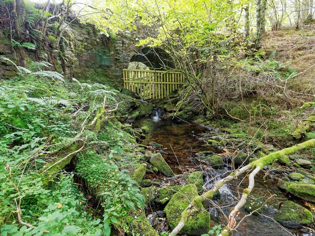
Image: © valenta Taken: 15 Sep 2018
This bridge is marked on the 1869 OS 6 inch map of the area. It was the only track up Strath Avon and has since been replaced by a modern concrete bridge. The wooden fence over the Allt na Glander in place to keep deer out of the nature reserve on the other side of the bridge. Rather surprisingly the bridge doesn't appear to be listed.
Images are licensed for reuse under creativecommons.org/licenses/by-sa/2.0
Image Location
Latitude
57.339694
Longitude
-3.381216