Muirkirk Miners' Memorial
Introduction
The photograph on this page of Muirkirk Miners' Memorial by Mary and Angus Hogg as part of the Geograph project.
The Geograph project started in 2005 with the aim of publishing, organising and preserving representative images for every square kilometre of Great Britain, Ireland and the Isle of Man.

There are currently over 7.5m images from over 14,400 individuals and you can help contribute to the project by visiting https://www.geograph.org.uk
Muirkirk Miners' Memorial
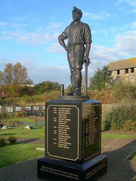
Image: © Mary and Angus Hogg Taken: 20 Oct 2007
This striking monument is located in the Muirkirk Heritage Park, opened in 2003. Formerly, Muirkirk was the centre of a thriving industrial area, with local coal mines, iron works and a tar works. The monument records the first colliery death as Matthew Holden in 1892. The last working mine, at Kames, was closed in 1968.
Images are licensed for reuse under creativecommons.org/licenses/by-sa/2.0
Image Location
Latitude
55.52197
Longitude
-4.067374