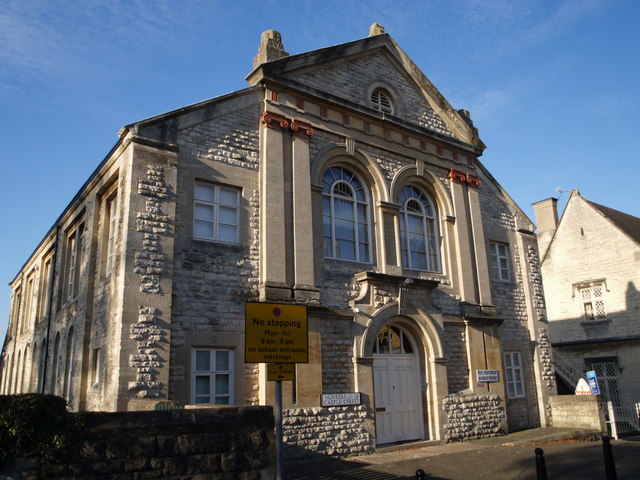
Former Stroud Methodist Church
Introduction
The photograph on this page of Former Stroud Methodist Church by Derek Harper as part of the Geograph project.
The Geograph project started in 2005 with the aim of publishing, organising and preserving representative images for every square kilometre of Great Britain, Ireland and the Isle of Man.
There are currently over 7.5m images from over 14,400 individuals and you can help contribute to the project by visiting https://www.geograph.org.uk

Image: © Derek Harper Taken: 19 Oct 2007
This dramatic Victorian neo-classical building dates from 1876 (dated). Here is the rest of the entry on an old document of listed buildings: "Rock-faced rustication with ashlar quoins. Pitched slate roof. 2 storeys. Palladian temple front: coupled Ionic pilasters taking entablature with pediment. Acroteria. Oculus in tympanum. 2 arcuated windows with glazing bars, keystones, moulded surrounds and imposts on 1st floor. Round arched doorway in Baroque surround. 2 storey flanking bay with 1 range of casements each, and ramped coping to roof." Acroteria, it turns out, are those decorations right on top of the pediment. The building, on Castle Street, has now been converted into flats and is called Castle Court.

