High Street, Odiham
Introduction
The photograph on this page of High Street, Odiham by Derek Harper as part of the Geograph project.
The Geograph project started in 2005 with the aim of publishing, organising and preserving representative images for every square kilometre of Great Britain, Ireland and the Isle of Man.

There are currently over 7.5m images from over 14,400 individuals and you can help contribute to the project by visiting https://www.geograph.org.uk
High Street, Odiham
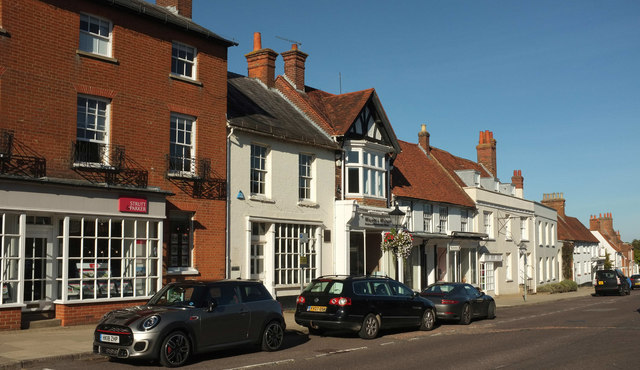
Image: © Derek Harper Taken: 17 Sep 2018
On the left is part of number 82 https://www.historicengland.org.uk/listing/the-list/list-entry/1092147 . Next door is the former Barclays Bank https://www.historicengland.org.uk/listing/the-list/list-entry/1339907 . Beyond the unlisted gabled building is https://www.historicengland.org.uk/listing/the-list/list-entry/1092177 , listed as Black Kettle Antiques, followed by Central House https://www.historicengland.org.uk/listing/the-list/list-entry/1272589 and Orchard House https://www.historicengland.org.uk/listing/the-list/list-entry/1339906 , the last two with parapets.
Images are licensed for reuse under creativecommons.org/licenses/by-sa/2.0
Image Location
Latitude
51.25417
Longitude
-0.939433