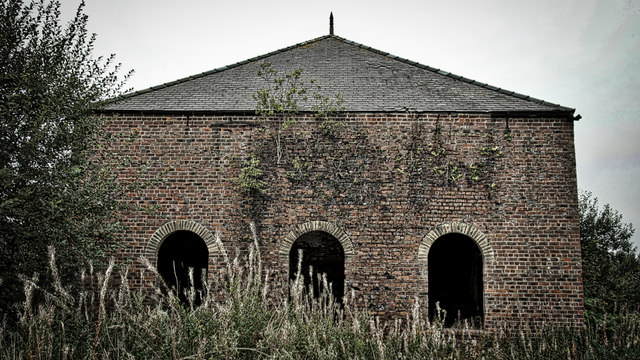
South Skelton Ironstone Mine
Introduction
The photograph on this page of South Skelton Ironstone Mine by Mick Garratt as part of the Geograph project.
The Geograph project started in 2005 with the aim of publishing, organising and preserving representative images for every square kilometre of Great Britain, Ireland and the Isle of Man.
There are currently over 7.5m images from over 14,400 individuals and you can help contribute to the project by visiting https://www.geograph.org.uk

Image: © Mick Garratt Taken: 22 Sep 2018
Most buildings associated with the ironstone mines of East Cleveland have either long since been demolished or converted for industrial use. South Skelton Mine is the one exception because I suppose it went into agricultural use. The farm has now been abandoned and I understand the site is now earmarked for residential development. Operations began at South Skelton in 1872 with Thomas Vaughan and Company and continued through several changes of ownership and with a few periods of mothballing until the 1950s by which time it was owned by Dorman, Long and Company. Unlike most East Cleveland ironstone mines which are drift mines, “Van’s Pit”, as it was known locally after Vaughan, was worked by two shafts of approximately 216′ depth. It was electrified in 1912 and underwent substantial modernisation in the 1930s when Dorman Long took over. Output was considerable, at its height, 300,000 tons were produced annually with 450 employees. The building in the photograph would have been the winding house for the upcast shaft. From my blog http://www.fhithich.uk/?p=20242

