Merkinch Welfare Hall
Introduction
The photograph on this page of Merkinch Welfare Hall by Craig Wallace as part of the Geograph project.
The Geograph project started in 2005 with the aim of publishing, organising and preserving representative images for every square kilometre of Great Britain, Ireland and the Isle of Man.

There are currently over 7.5m images from over 14,400 individuals and you can help contribute to the project by visiting https://www.geograph.org.uk
Merkinch Welfare Hall
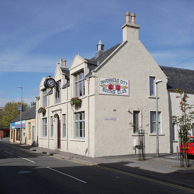
Image: © Craig Wallace Taken: 20 Sep 2018
At 30 Grant Street, next to the junction with Brown Street. The welfare hall was built in 1914 for the Catch-my-Pal Union, a temperance organisation. The drum clock was originally on the town steeple, before it was brought here in 1931. After lying derelict for a number of years, the hall was restored in 2017. It is now in use by Inverness City Boxing Club and Merkinch Partnership. It is a Category C listed building. http://portal.historicenvironment.scot/designation/LB43488 For another view, see Image A similar view from 2011 Image
Images are licensed for reuse under creativecommons.org/licenses/by-sa/2.0
Image Location
Latitude
57.484501
Longitude
-4.234287