Canal arm on Frog Island in Leicester
Introduction
The photograph on this page of Canal arm on Frog Island in Leicester by Roger Kidd as part of the Geograph project.
The Geograph project started in 2005 with the aim of publishing, organising and preserving representative images for every square kilometre of Great Britain, Ireland and the Isle of Man.

There are currently over 7.5m images from over 14,400 individuals and you can help contribute to the project by visiting https://www.geograph.org.uk
Canal arm on Frog Island in Leicester
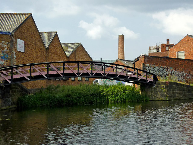
Image: © Roger Kidd Taken: 25 Aug 2013
The Grand Union Canal/Soar Navigation continues off to the right (north-east), two hundred metres to North Lock. This disused short arm and basin is on Frog Island beyond the purple towpath bridge. The canal here was engineered to improve the Soar Navigation flood management in the late nineteenth century.
Images are licensed for reuse under creativecommons.org/licenses/by-sa/2.0
Image Location
Latitude
52.64038
Longitude
-1.145343