Coal tax boundary marker no.78, Park Street, Colnbrook
Introduction
The photograph on this page of Coal tax boundary marker no.78, Park Street, Colnbrook by Mike Quinn as part of the Geograph project.
The Geograph project started in 2005 with the aim of publishing, organising and preserving representative images for every square kilometre of Great Britain, Ireland and the Isle of Man.

There are currently over 7.5m images from over 14,400 individuals and you can help contribute to the project by visiting https://www.geograph.org.uk
Coal tax boundary marker no.78, Park Street, Colnbrook
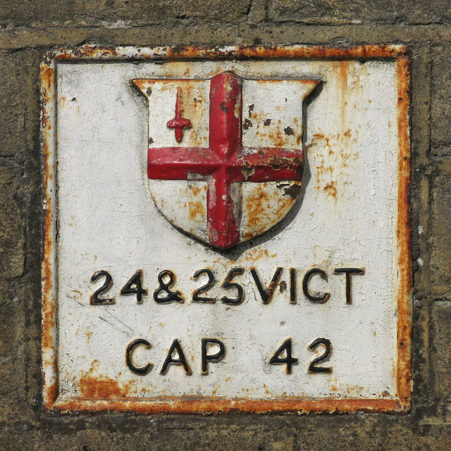
Image: © Mike Quinn Taken: 8 Aug 2018
The location of this boundary marker is shown in Image and Image There were originally nearly 280 coal tax posts located around London, of which about 210 are still extant; around 180 of these (85%) are 3 ft high white-painted square bollards with a pyramidal top, decorative raised bands, and the shield from the City of London’s arms. Photos of the coal tax posts on Geograph are at http://www.geograph.org.uk/search.php?i=86542993&page=1 . There are just 4 extant markers in situ of the type shown in the photo; the other three are Image, Image and Image The only other example is in a museum. The posts were erected under the Coal and Wine Duties (Continuation) Act of 1861 to mark the points at which duty had to be paid on coal being transported to London. The boundary was set at that of the Metropolitan Police District, and the resulting revenue was used by the Corporation of the City of London to fund public works. For further info see http://www.coaldutyposts.org.uk/cityposts.html .
Images are licensed for reuse under creativecommons.org/licenses/by-sa/2.0
Image Location
Latitude
51.482985
Longitude
-0.521241