Varsity Line
Introduction
The photograph on this page of Varsity Line by Andrew Bodman as part of the Geograph project.
The Geograph project started in 2005 with the aim of publishing, organising and preserving representative images for every square kilometre of Great Britain, Ireland and the Isle of Man.

There are currently over 7.5m images from over 14,400 individuals and you can help contribute to the project by visiting https://www.geograph.org.uk
Varsity Line
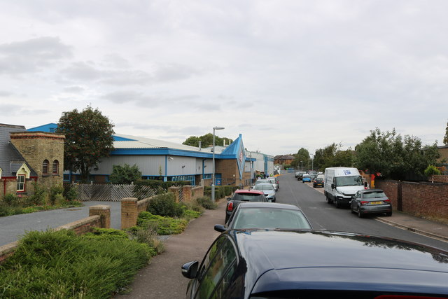
Image: © Andrew Bodman Taken: 10 Sep 2018
The Varsity Line connected Oxford and Cambridge and train services ran on the section between Bedford and Cambridge until the end of 1967 https://en.wikipedia.org/wiki/Varsity_Line . Plans are underway to reopen the line in stages between Oxford and Cambridge, and the route is now known as East West Rail. Some local authorities have taken steps to protect disused rail routes. Hence much of the original alignment between Oxford and Bedford will be/is being reused as it was because it was not built over in the meantime. However, there are several places between Bedford and Cambridge where the old route has been built over, and consequently a completely fresh route is likely to be constructed for this section. Part of the (second) Potton Station can be seen in the foreground on the left, this now being used as a house. The road straight ahead is Shannon Place. The business premises on the left are built on the alignment of the Varsity Line, which was situated on the far side of the station and ran parallel to Shannon Place. Additional history of the railway and stations in this village may be found from other Geograph contributors and from http://www.disused-stations.org.uk/p/potton/index.shtml More details of future plans for East West Rail are available from https://www.eastwestrail.org.uk/central-section-overview/
Images are licensed for reuse under creativecommons.org/licenses/by-sa/2.0
Image Location
Latitude
52.128116
Longitude
-0.220212