Chesham: Lord's Mill Barn
Introduction
The photograph on this page of Chesham: Lord's Mill Barn by Nigel Cox as part of the Geograph project.
The Geograph project started in 2005 with the aim of publishing, organising and preserving representative images for every square kilometre of Great Britain, Ireland and the Isle of Man.

There are currently over 7.5m images from over 14,400 individuals and you can help contribute to the project by visiting https://www.geograph.org.uk
Chesham: Lord's Mill Barn
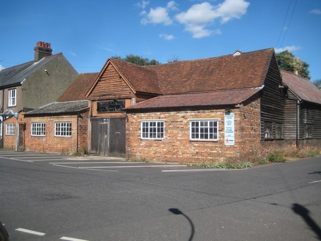
Image: © Nigel Cox Taken: 13 Sep 2018
The barn is attached to Image] and is also a Grade II Listed Building. The Historic England website describes it thus:- "C17 or earlier. Timber frame, weatherboarding, tiled roof. Included for group value. Lord's Mill and Lord's Mill House and barn form a group." In fact Lord's Mill itself was demolished in the 1980s. The Ordnance Survey map editions of 1898 and 1925 both describe this building as the Riverside Iron Works, so evidently it was not used in any milling activities by at least the earlier of the two dates.
Images are licensed for reuse under creativecommons.org/licenses/by-sa/2.0
Image Location
Latitude
51.696683
Longitude
-0.606024