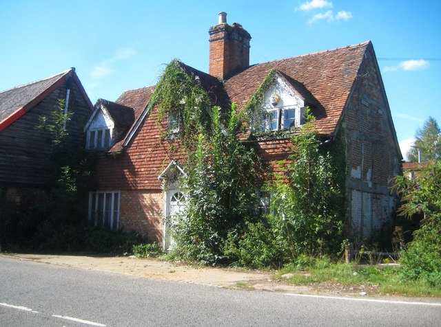
Chesham: Lord's Mill House
Introduction
The photograph on this page of Chesham: Lord's Mill House by Nigel Cox as part of the Geograph project.
The Geograph project started in 2005 with the aim of publishing, organising and preserving representative images for every square kilometre of Great Britain, Ireland and the Isle of Man.
There are currently over 7.5m images from over 14,400 individuals and you can help contribute to the project by visiting https://www.geograph.org.uk

Image: © Nigel Cox Taken: 13 Sep 2018
This Grade II Listed Building, on Moor Road, and with a significant connection with Chesham's industrial past, is currently in this state. Lord's Mill itself was a corn mill on the River Chess, constructed in 1660, and was at one time Chesham's oldest secular building. It ceased working in the 1950s, and after a period of neglect and decay, had to be demolished in the 1980s. It stood abutting this house on its right hand side in this image. The Historic England website describes the house thus:- "Late C16 or early C17, altered. Whitewashed brick ground floor, tile hung 1st floor, old tiled roof. 2 storeys, 2 C19 casement windows to ground floor, 2 gabled casement dormers to 1st floor either side of central gable with casement. Central doorway with ribbed wooden surround under open pediment on consoles. Large central red brick chimneystack with square plan shafts." The book "Chesham through Time" states that "the mill house was carefully restored in 1982".

