Along Grimston Road
Introduction
The photograph on this page of Along Grimston Road by John Sutton as part of the Geograph project.
The Geograph project started in 2005 with the aim of publishing, organising and preserving representative images for every square kilometre of Great Britain, Ireland and the Isle of Man.

There are currently over 7.5m images from over 14,400 individuals and you can help contribute to the project by visiting https://www.geograph.org.uk
Along Grimston Road
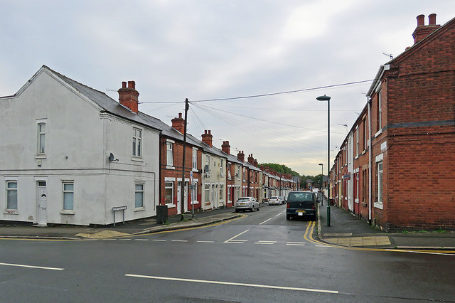
Image: © John Sutton Taken: 12 Sep 2018
Looking towards Radford Boulevard and Alfreton Road from Churchfield Lane on a grey September morning. Until the late 1930s this was the edge of Nottingham in these parts. Behind the camera are houses built just before the War as the city began the huge westward expansion which continued in the fifties and sixties. The white house on the left used to be a corner sweet shop.
Images are licensed for reuse under creativecommons.org/licenses/by-sa/2.0
Image Location
Latitude
52.963354
Longitude
-1.179783