Church Street, Harwich
Introduction
The photograph on this page of Church Street, Harwich by Robin Webster as part of the Geograph project.
The Geograph project started in 2005 with the aim of publishing, organising and preserving representative images for every square kilometre of Great Britain, Ireland and the Isle of Man.

There are currently over 7.5m images from over 14,400 individuals and you can help contribute to the project by visiting https://www.geograph.org.uk
Church Street, Harwich
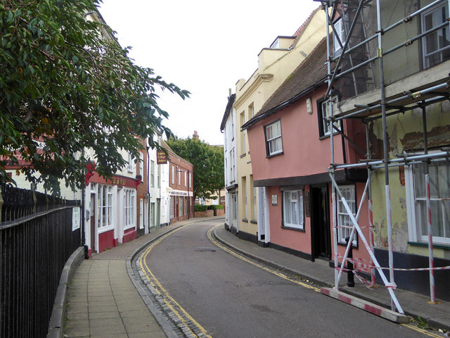
Image: © Robin Webster Taken: 8 Sep 2018
The churchyard railings are on the left, with beyond the grade II listed Hanover Inn. The jettied pink house is 16th century, grade II listed, formerly an inn.
Images are licensed for reuse under creativecommons.org/licenses/by-sa/2.0
Image Location
Latitude
51.945283
Longitude
1.288701