Chiswick: 3 - 21 Chiswick High Road, W4
Introduction
The photograph on this page of Chiswick: 3 - 21 Chiswick High Road, W4 by Nigel Cox as part of the Geograph project.
The Geograph project started in 2005 with the aim of publishing, organising and preserving representative images for every square kilometre of Great Britain, Ireland and the Isle of Man.

There are currently over 7.5m images from over 14,400 individuals and you can help contribute to the project by visiting https://www.geograph.org.uk
Chiswick: 3 - 21 Chiswick High Road, W4
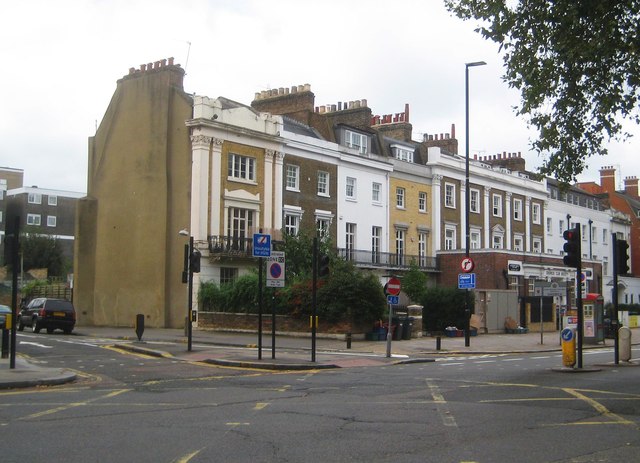
Image: © Nigel Cox Taken: 12 Sep 2018
The first building on the left (No 3), the next group of three (Nos 5 - 9), the two wider ones in the middle (Nos 11 -13 and 15 - 19) and the white one just in sight at the end on the right (No 21), are all separately Grade II Listed. They were all built circa 1830 - 1840. Old Victorian maps show them as a block called William's Terrace, and also that that was a No 1 to the left. This has since been demolished, probably in order to widen the road (British Grove). Nos 11 - 13, with the ground floor front extension, are occupied by the Chiswick Club Society.
Images are licensed for reuse under creativecommons.org/licenses/by-sa/2.0
Image Location
Latitude
51.493124
Longitude
-0.245629