1 - 13 Orwell Road, Dovercourt (rear view)
Introduction
The photograph on this page of 1 - 13 Orwell Road, Dovercourt (rear view) by Robin Webster as part of the Geograph project.
The Geograph project started in 2005 with the aim of publishing, organising and preserving representative images for every square kilometre of Great Britain, Ireland and the Isle of Man.

There are currently over 7.5m images from over 14,400 individuals and you can help contribute to the project by visiting https://www.geograph.org.uk
1 - 13 Orwell Road, Dovercourt (rear view)
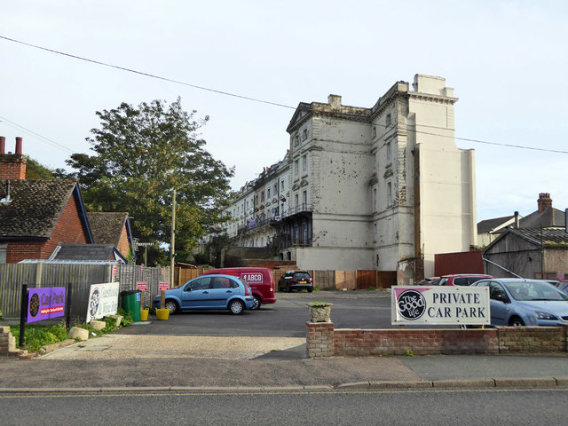
Image: © Robin Webster Taken: 8 Sep 2018
A grade II listed building of the 1850s, the only completed part of Dovercourt New Town, but the developer went bankrupt and the project died. There was originally another house at the far end, The Convent, which completed a symmetrical block. This is described in the 1972 listing, but is now demolished.
Images are licensed for reuse under creativecommons.org/licenses/by-sa/2.0
Image Location
Latitude
51.937245
Longitude
1.283456