Harrison House, Main Road, Dovercourt
Introduction
The photograph on this page of Harrison House, Main Road, Dovercourt by Robin Webster as part of the Geograph project.
The Geograph project started in 2005 with the aim of publishing, organising and preserving representative images for every square kilometre of Great Britain, Ireland and the Isle of Man.

There are currently over 7.5m images from over 14,400 individuals and you can help contribute to the project by visiting https://www.geograph.org.uk
Harrison House, Main Road, Dovercourt
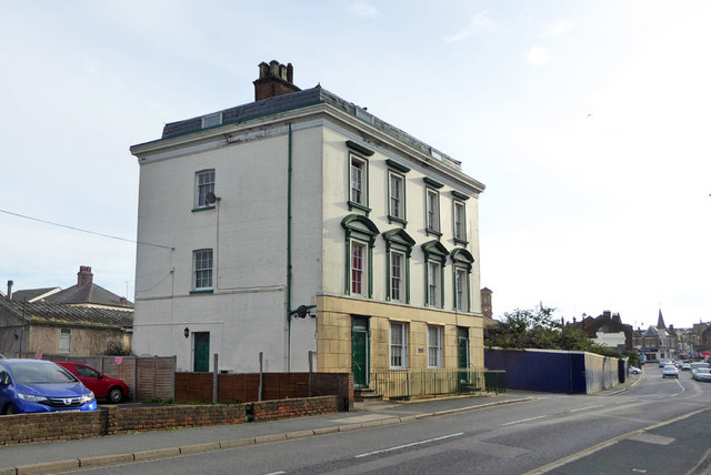
Image: © Robin Webster Taken: 8 Sep 2018
A mid 19th century grade II listed building. The listing describes it as 'Shops with flats' and makes no mention of the areas and basement level, instead describing 'projecting flat-roofed shops'. These have evidently been removed and the basement exposed. It looks very convincing - is this a reversion to the original state?
Images are licensed for reuse under creativecommons.org/licenses/by-sa/2.0
Image Location
Latitude
51.937714
Longitude
1.282763