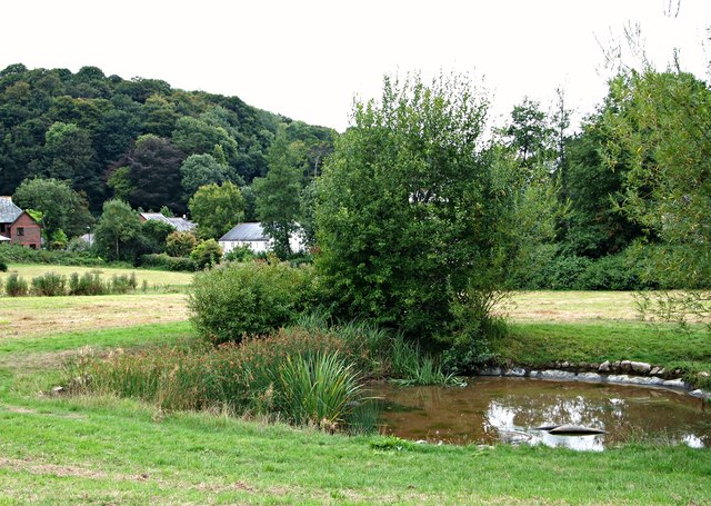
Pathfields, Plympton St Maurice, Devon
Introduction
The photograph on this page of Pathfields, Plympton St Maurice, Devon by David Hallam-Jones as part of the Geograph project.
The Geograph project started in 2005 with the aim of publishing, organising and preserving representative images for every square kilometre of Great Britain, Ireland and the Isle of Man.
There are currently over 7.5m images from over 14,400 individuals and you can help contribute to the project by visiting https://www.geograph.org.uk

Image: © David Hallam-Jones Taken: 18 Aug 2018
Pathfields, a large green space of 11 hectares, includes wildflower areas, a woodland, hedgerows and extensive fields. The area is managed jointly by the local council and the local Civic Association. In 2008, a Plympton conservation and management plan highlighted an intention to construct a pond within this particular area to create some wetland habitat and this has clearly been achieved. This field is used for occasional for community events, e.g. the summer fair. Elsewhere there is an unmetalled path crossing Pathfields from east to west, i.e. from Mudge Way to Barbican Road. The houses in the distance seem likely to be situated on minor 'estate roads' off The Ridgeway.

