Metrolink Phase 1/2 Ticket Machine (detail 2)
Introduction
The photograph on this page of Metrolink Phase 1/2 Ticket Machine (detail 2) by David Dixon as part of the Geograph project.
The Geograph project started in 2005 with the aim of publishing, organising and preserving representative images for every square kilometre of Great Britain, Ireland and the Isle of Man.

There are currently over 7.5m images from over 14,400 individuals and you can help contribute to the project by visiting https://www.geograph.org.uk
Metrolink Phase 1/2 Ticket Machine (detail 2)
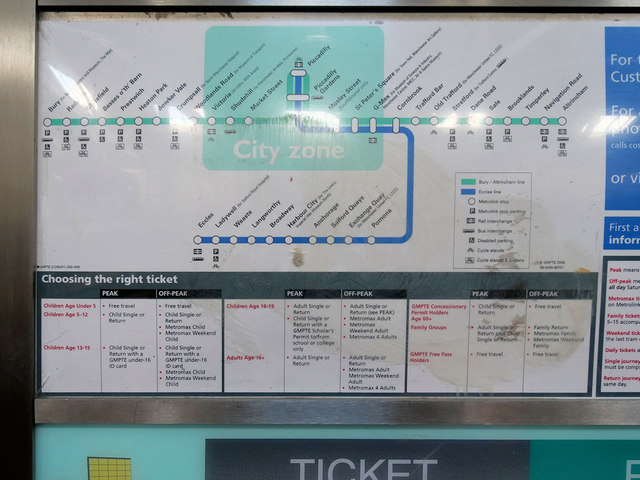
Image: © David Dixon Taken: 31 Aug 2018
A closer look at Image] showing the route map in the corporate colour scheme of blue/grey/white which was in use at the time of its withdrawal in 2010. At that time, only phases 1 and 2 of the network had been constructed and the map is much simpler than it is today! Of particular note are the stations at Woodlands Road - now demolished and replaced by the Queen's Road stop, Mosley Street - now demolished, and G-Mex - now renamed Deansgate-Castlefield.
Images are licensed for reuse under creativecommons.org/licenses/by-sa/2.0
Image Location
Latitude
53.594386
Longitude
-2.300776