Abertillery Emergency Services Station
Introduction
The photograph on this page of Abertillery Emergency Services Station by M J Roscoe as part of the Geograph project.
The Geograph project started in 2005 with the aim of publishing, organising and preserving representative images for every square kilometre of Great Britain, Ireland and the Isle of Man.

There are currently over 7.5m images from over 14,400 individuals and you can help contribute to the project by visiting https://www.geograph.org.uk
Abertillery Emergency Services Station
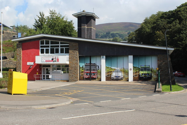
Image: © M J Roscoe Taken: 31 Aug 2018
The former fire station now houses the three emergency services. Each has its own vehicle bay, hence the pictures on the doors.
Images are licensed for reuse under creativecommons.org/licenses/by-sa/2.0
Image Location
Latitude
51.730383
Longitude
-3.136303