Victoria Tunnel
Introduction
The photograph on this page of Victoria Tunnel by David Robinson as part of the Geograph project.
The Geograph project started in 2005 with the aim of publishing, organising and preserving representative images for every square kilometre of Great Britain, Ireland and the Isle of Man.

There are currently over 7.5m images from over 14,400 individuals and you can help contribute to the project by visiting https://www.geograph.org.uk
Victoria Tunnel
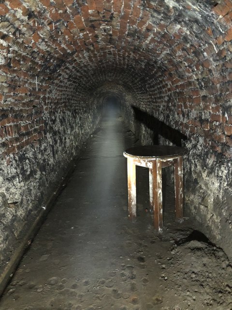
Image: © David Robinson Taken: 2 Sep 2018
Victoria Tunnel, 85 ft below the streets of Newcastle. Built to take coal from a colliery beside the town moor down to staithes at Ouseburn, the tunnel is 2 1/2 miles long and opened in 1842. Sets of 8 wagons were rope hauled by a stationary steam engine at the colliery. Though massively reducing the transit costs for the colliery, the colliery itself wasn’t a success and closed in 1860, the tunnel working for only 18 years. Largely forgotten until use as an air raid shelter in WW2, now the bottom section is open to public tours. The central section contains a large bore pipe that is the storm drain for the central motorway, the upper section is accessible but not open to the public
Images are licensed for reuse under creativecommons.org/licenses/by-sa/2.0
Image Location
Latitude
54.973638
Longitude
-1.59739