Plaque, former Drill Hall
Introduction
The photograph on this page of Plaque, former Drill Hall by Ian Capper as part of the Geograph project.
The Geograph project started in 2005 with the aim of publishing, organising and preserving representative images for every square kilometre of Great Britain, Ireland and the Isle of Man.

There are currently over 7.5m images from over 14,400 individuals and you can help contribute to the project by visiting https://www.geograph.org.uk
Plaque, former Drill Hall
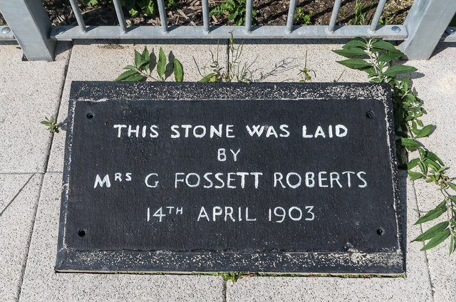
Image: © Ian Capper Taken: 29 Aug 2018
Plaque commemorating the former Drill Hall in Glyndwr Road, the site of which forms part of the joint Tesco/Marks and Spencer development on Park Avenue, completed in 2016. It reads "This stone was laid by Mrs G Fossett Roberts 14th April 1903". See Image for wider view. I assume this is the original foundation stone (see Image) stripped of paint and with the lettering now highlighted in white.
Images are licensed for reuse under creativecommons.org/licenses/by-sa/2.0
Image Location
Latitude
52.411653
Longitude
-4.083369