Horeb English Baptist Chapel, Nantymoel
Introduction
The photograph on this page of Horeb English Baptist Chapel, Nantymoel by Jaggery as part of the Geograph project.
The Geograph project started in 2005 with the aim of publishing, organising and preserving representative images for every square kilometre of Great Britain, Ireland and the Isle of Man.

There are currently over 7.5m images from over 14,400 individuals and you can help contribute to the project by visiting https://www.geograph.org.uk
Horeb English Baptist Chapel, Nantymoel
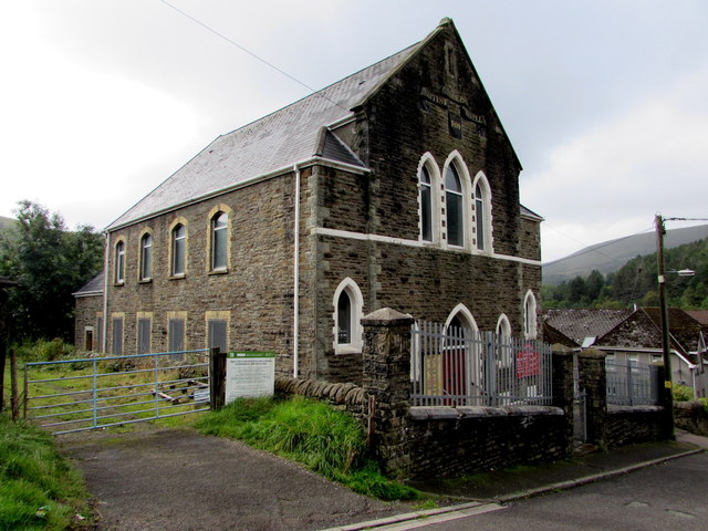
Image: © Jaggery Taken: 29 Aug 2018
Alongside Dinam Close opposite Chapel Street. In August 2018 the church nameboard https://www.geograph.org.uk/photo/5888995 shows the days and times of the weekly services here. The board also shows the other uses of the building - Sunday School, Ladies Guild, Kids Bible Club, Teen Fellowship meetings. A tablet on the wall above the upper windows shows the year 1894.
Images are licensed for reuse under creativecommons.org/licenses/by-sa/2.0
Image Location
Latitude
51.621852
Longitude
-3.538933