Republican hoarding near Cregganduff Road junction on the B30
Introduction
The photograph on this page of Republican hoarding near Cregganduff Road junction on the B30 by Eric Jones as part of the Geograph project.
The Geograph project started in 2005 with the aim of publishing, organising and preserving representative images for every square kilometre of Great Britain, Ireland and the Isle of Man.

There are currently over 7.5m images from over 14,400 individuals and you can help contribute to the project by visiting https://www.geograph.org.uk
Republican hoarding near Cregganduff Road junction on the B30
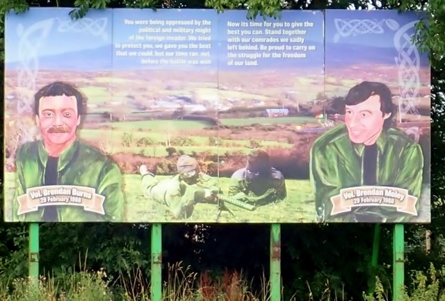
Image: © Eric Jones Taken: 21 Aug 2018
This area is in the heart of Republican South Armagh. It is an area which includes Creggan, Crossmaglen and Cullyhanna. Burns and Moley were killed when a 300lb bomb they were transporting blew up prematurely. https://www.upi.com/Archives/1988/03/02/IRAs-top-fugitive-killed-in-bomb-blast/2239573282000/
Images are licensed for reuse under creativecommons.org/licenses/by-sa/2.0
Image Location
Latitude
54.092849
Longitude
-6.562411