Ardnadam Pier
Introduction
The photograph on this page of Ardnadam Pier by Thomas Nugent as part of the Geograph project.
The Geograph project started in 2005 with the aim of publishing, organising and preserving representative images for every square kilometre of Great Britain, Ireland and the Isle of Man.

There are currently over 7.5m images from over 14,400 individuals and you can help contribute to the project by visiting https://www.geograph.org.uk
Ardnadam Pier
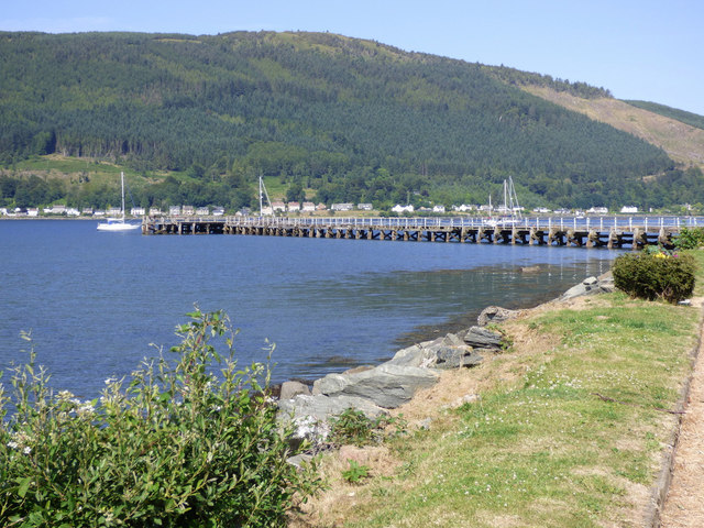
Image: © Thomas Nugent Taken: 2 Jul 2018
On the south shore of the Holy Loch. The pier was opened in 1858 to serve a growing development of marine villas to the north-west of Sandbank and is the longest steamer pier on the upper firth of Clyde. The pier was used by steamer services in the heyday of the Clyde steamers before the First World War, but was closed to commercial use in 1940 and never reopened. It was used for military purposes when the US Navy base at Holy Loch was in operation (1961-1992).
Images are licensed for reuse under creativecommons.org/licenses/by-sa/2.0
Image Location


Leaflet Map data © OpenStreetMap
Latitude
55.981707
Longitude
-4.940884