
Coquet Cottages, The Butts, Warkworth
Introduction
The photograph on this page of Coquet Cottages, The Butts, Warkworth by Andrew Curtis as part of the Geograph project.
The Geograph project started in 2005 with the aim of publishing, organising and preserving representative images for every square kilometre of Great Britain, Ireland and the Isle of Man.

There are currently over 7.5m images from over 14,400 individuals and you can help contribute to the project by visiting https://www.geograph.org.uk
Coquet Cottages, The Butts, Warkworth
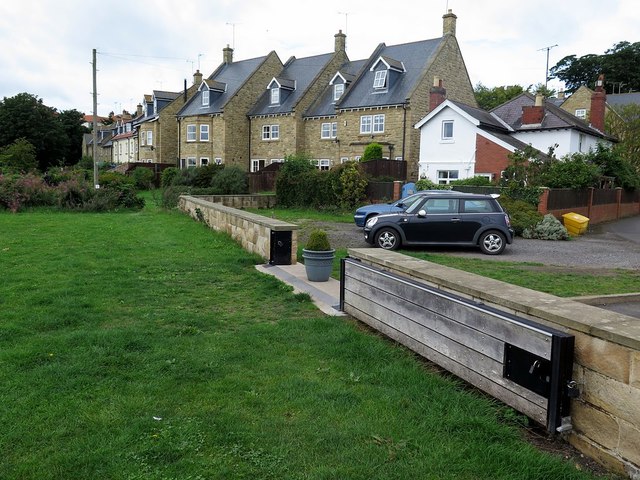
Image: © Andrew Curtis Taken: 18 Aug 2018
"The Butts is the portion of the village on the low-lying flats by the river-side on the east of the ancient village, and appears to be of recent date, in fact it may be readily assumed that this part of Warkworth has been reclaimed from the old river-bed." Amble & District by T L McAndrews (1910) https://www.fusilier.co.uk/amble_and_district_mcandrews/amble_northumberland_history.htm Flood defence wall and gates in the foreground. The 230-metre-long flood wall, with sandstone cladding was completed in September 2014 at a cost of £350,000. It now protects 35 houses from flooding by the tidal River Coquet. The two flood gates at The Butts are closed and locked by the Environment Agency when river levels are high and flooding is expected, protecting properties by holding water behind the wall. https://www.chroniclelive.co.uk/news/north-east-news/new-flood-gates-showcased-northumberland-8242042
Images are licensed for reuse under creativecommons.org/licenses/by-sa/2.0
Image Location

Latitude
55.345517
Longitude
-1.609397