Former brewhouse at The Boat Inn
Introduction
The photograph on this page of Former brewhouse at The Boat Inn by Richard Law as part of the Geograph project.
The Geograph project started in 2005 with the aim of publishing, organising and preserving representative images for every square kilometre of Great Britain, Ireland and the Isle of Man.

There are currently over 7.5m images from over 14,400 individuals and you can help contribute to the project by visiting https://www.geograph.org.uk
Former brewhouse at The Boat Inn
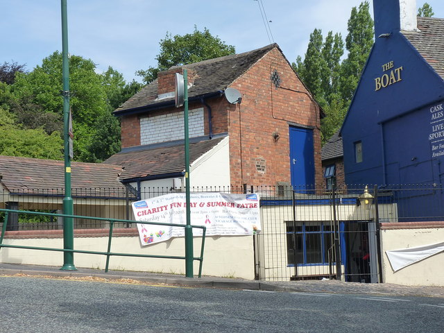
Image: © Richard Law Taken: 19 Jul 2018
Grade II listed https://britishlistedbuildings.co.uk/101205529-brewhouse-to-left-of-the-boat-public-house-wednesfield-south-ward in 1990, along with the pub itself, this former brewhouse is a rare survivor of the times when many Black Country pubs had their own micro-brewery on site as necessity. It's now become something of a sales point in a number of locals.
Images are licensed for reuse under creativecommons.org/licenses/by-sa/2.0
Image Location
Latitude
52.59983
Longitude
-2.083818