#31 Hill Street
Introduction
The photograph on this page of #31 Hill Street by Roger Templeman as part of the Geograph project.
The Geograph project started in 2005 with the aim of publishing, organising and preserving representative images for every square kilometre of Great Britain, Ireland and the Isle of Man.

There are currently over 7.5m images from over 14,400 individuals and you can help contribute to the project by visiting https://www.geograph.org.uk
#31 Hill Street
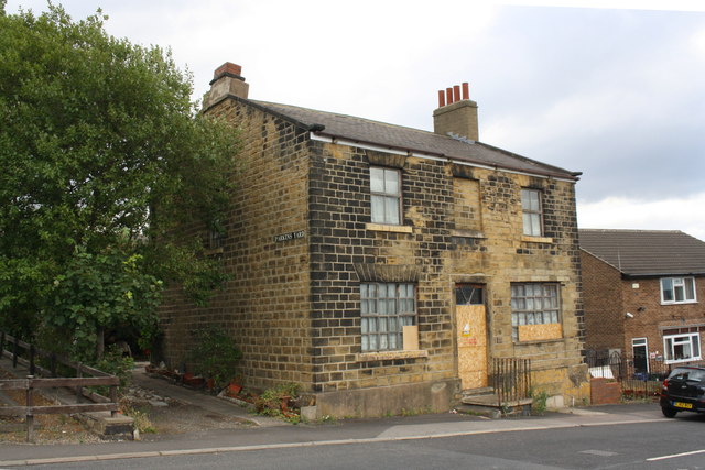
Image: © Roger Templeman Taken: 14 Aug 2018
Described by the Ordnance Survey as a public house, but probably only licensed for beer .. more than it does now! There is an OS benchmark Image on the near corner, left hand face, of the building, under the Parkins Yard name sign
Images are licensed for reuse under creativecommons.org/licenses/by-sa/2.0
Image Location
Latitude
53.49865
Longitude
-1.425766