Former Ashby Cottage Hospital, Leicester Road, Ashby-de-la-Zouch
Introduction
The photograph on this page of Former Ashby Cottage Hospital, Leicester Road, Ashby-de-la-Zouch by Alan Murray-Rust as part of the Geograph project.
The Geograph project started in 2005 with the aim of publishing, organising and preserving representative images for every square kilometre of Great Britain, Ireland and the Isle of Man.

There are currently over 7.5m images from over 14,400 individuals and you can help contribute to the project by visiting https://www.geograph.org.uk
Former Ashby Cottage Hospital, Leicester Road, Ashby-de-la-Zouch
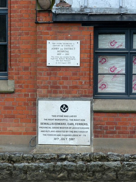
Image: © Alan Murray-Rust Taken: 5 Aug 2018
Commemorative plaques recording the building in 1897 and the centenary in 1997. The building was being converted to residential use at the time of my visit.
Images are licensed for reuse under creativecommons.org/licenses/by-sa/2.0
Image Location
Latitude
52.747877
Longitude
-1.463532