A stretch of the Curly Wyrley
Introduction
The photograph on this page of A stretch of the Curly Wyrley by Richard Law as part of the Geograph project.
The Geograph project started in 2005 with the aim of publishing, organising and preserving representative images for every square kilometre of Great Britain, Ireland and the Isle of Man.

There are currently over 7.5m images from over 14,400 individuals and you can help contribute to the project by visiting https://www.geograph.org.uk
A stretch of the Curly Wyrley
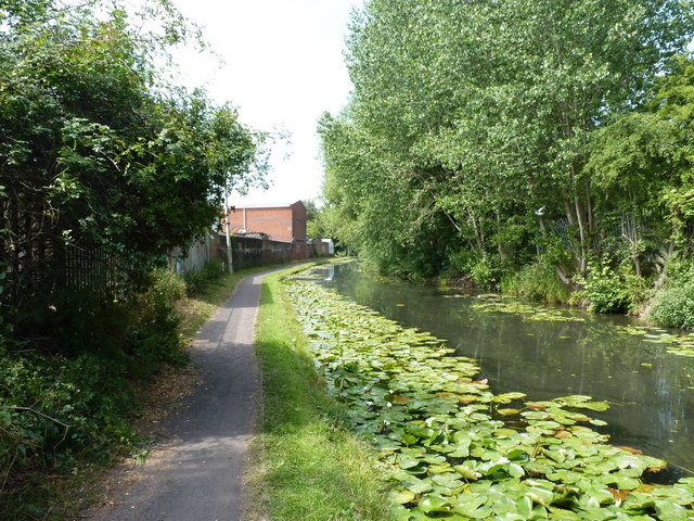
Image: © Richard Law Taken: 19 Jul 2018
Pretty much the same piece of canal as Image, but photographed a few weeks later, by which time the lilies have flourished in the warm weather. The Wyrley and Essington Canal (it's pronounced 'wurly' or 'whirly', hence the Curly Wurly is an alternative local name for this cut with its many corners) received its Parliamentary and Royal Assent in the early 1790s, and was built over the next few years under the guidance of the principal engineer William Pitt - presumably not the politician who went on to become William Pitt the Younger, Prime Minister in 1783, as he'd only have been in his late teens whilst building this. The canal's main stated purpose was to carry coal and limestone from the workings of the Staffordshire collieries around Cannock into the industrial area that would become known as The Black Country
Images are licensed for reuse under creativecommons.org/licenses/by-sa/2.0
Image Location
Latitude
52.59902
Longitude
-2.085588