Fishermans Arms Day Centre, South Street, Bridport
Introduction
The photograph on this page of Fishermans Arms Day Centre, South Street, Bridport by Jaggery as part of the Geograph project.
The Geograph project started in 2005 with the aim of publishing, organising and preserving representative images for every square kilometre of Great Britain, Ireland and the Isle of Man.

There are currently over 7.5m images from over 14,400 individuals and you can help contribute to the project by visiting https://www.geograph.org.uk
Fishermans Arms Day Centre, South Street, Bridport
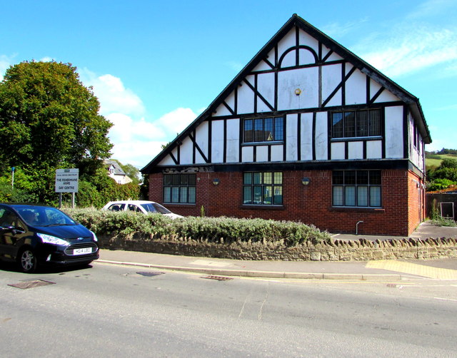
Image: © Jaggery Taken: 25 Aug 2017
Viewed in August 2017. The name sign on the left shows that the day centre is part of Dorset County Council's Social Services Directorate. This later photo https://www.geograph.org.uk/photo/5851440 taken in July 2018 shows that the day centre has closed down. The Closed Pubs website records that the building was erected in the 1930s as the Fishermans Arms pub. Planning permission for change of use was granted to Palmers Brewery in January 1998.
Images are licensed for reuse under creativecommons.org/licenses/by-sa/2.0
Image Location
Latitude
50.728213
Longitude
-2.757807