Bow Street, Langport
Introduction
The photograph on this page of Bow Street, Langport by Derek Harper as part of the Geograph project.
The Geograph project started in 2005 with the aim of publishing, organising and preserving representative images for every square kilometre of Great Britain, Ireland and the Isle of Man.

There are currently over 7.5m images from over 14,400 individuals and you can help contribute to the project by visiting https://www.geograph.org.uk
Bow Street, Langport
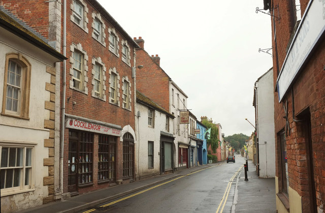
Image: © Derek Harper Taken: 11 Aug 2018
A series of listed buildings lines the south (left) side of the A378. First here on the immediate left is part of the Old Market House, formerly an inn https://www.historicengland.org.uk/listing/the-list/list-entry/1056639 . Cocklemoor gift and craft shop occupies Ensor House https://www.historicengland.org.uk/listing/the-list/list-entry/1264902 : "Stylistically the building could be by Nathaniel Ireson - the Hoare family of Stourhead were Lords of the Manor, and Ireson worked for the Hoare family elsewhere." After the two-storey building https://www.historicengland.org.uk/listing/the-list/list-entry/1346048 is The Angel Inn, listed as The Old Custom House Inn https://www.historicengland.org.uk/listing/the-list/list-entry/1235787 . Beyond are https://www.historicengland.org.uk/listing/the-list/list-entry/1056640 and https://www.historicengland.org.uk/listing/the-list/list-entry/1346105 .
Images are licensed for reuse under creativecommons.org/licenses/by-sa/2.0
Image Location
Latitude
51.037155
Longitude
-2.830298