Tuag at Gelli Fawr / Towards Gelli Fawr
Introduction
The photograph on this page of Tuag at Gelli Fawr / Towards Gelli Fawr by Alan Richards as part of the Geograph project.
The Geograph project started in 2005 with the aim of publishing, organising and preserving representative images for every square kilometre of Great Britain, Ireland and the Isle of Man.

There are currently over 7.5m images from over 14,400 individuals and you can help contribute to the project by visiting https://www.geograph.org.uk
Tuag at Gelli Fawr / Towards Gelli Fawr
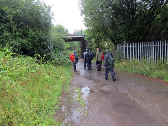
Image: © Alan Richards Taken: 12 Aug 2018
Cerddwyr yn dilyn heol sy'n arwain at anhedd-dy o'r enw Gelli Fawr. Cludai'r bont yn y pellter reilffordd a ai at hen Lofa Abernant. Walkers following a road to a property known as Gelli Fawr (trans. big grove). The bridge in the distance carried the mineral railway to the former Abernant Colliery (trans. confluence of the stream)
Images are licensed for reuse under creativecommons.org/licenses/by-sa/2.0
Image Location
Latitude
51.784192
Longitude
-3.882402