Straw incorporation
Introduction
The photograph on this page of Straw incorporation by Bob Harvey as part of the Geograph project.
The Geograph project started in 2005 with the aim of publishing, organising and preserving representative images for every square kilometre of Great Britain, Ireland and the Isle of Man.

There are currently over 7.5m images from over 14,400 individuals and you can help contribute to the project by visiting https://www.geograph.org.uk
Straw incorporation
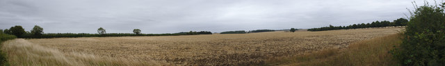
Image: © Bob Harvey Taken: 12 Aug 2018
This field has been clutivated after the harvest. It may even have been sown, that would be sensible. The row of trees on the left is the avenue to South Lodge. The hedge on the right is the field boundary, because this panorama is nearly 180 degrees wide
Images are licensed for reuse under creativecommons.org/licenses/by-sa/2.0
Image Location
Latitude
52.878486
Longitude
-0.442566