The End of the Line
Introduction
The photograph on this page of The End of the Line by David Robinson as part of the Geograph project.
The Geograph project started in 2005 with the aim of publishing, organising and preserving representative images for every square kilometre of Great Britain, Ireland and the Isle of Man.

There are currently over 7.5m images from over 14,400 individuals and you can help contribute to the project by visiting https://www.geograph.org.uk
The End of the Line
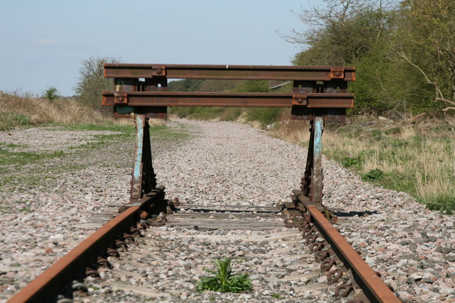
Image: © David Robinson Taken: 15 Apr 2014
A buffer stop marks the end of the short spur of track on what was the Leamside route between Tursdale Junction and Pelaw Junction. This was the first route of the main line from York - Newcastle, before the section between Tursdale Junction and Relly Mill junction at Durham was built in 1872. The bulk of the line closed in 1991, track was lifted in 2013.
Images are licensed for reuse under creativecommons.org/licenses/by-sa/2.0
Image Location
Latitude
54.715771
Longitude
-1.534441