Sign on Old Lindley Moor, Old Lindley
Introduction
The photograph on this page of Sign on Old Lindley Moor, Old Lindley by Humphrey Bolton as part of the Geograph project.
The Geograph project started in 2005 with the aim of publishing, organising and preserving representative images for every square kilometre of Great Britain, Ireland and the Isle of Man.

There are currently over 7.5m images from over 14,400 individuals and you can help contribute to the project by visiting https://www.geograph.org.uk
Sign on Old Lindley Moor, Old Lindley
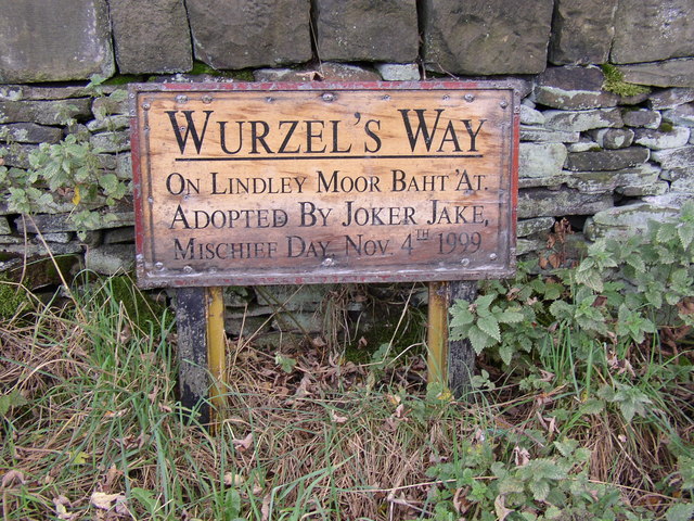
Image: © Humphrey Bolton Taken: 15 Oct 2007
Above the steep escarpment of old Lindley Moor is a flat-topped ridge. This was transferred to Huddersfield CB in 1913, and part of it became a cricket ground, part a 'crippled children's home' and part a 'recreation ground' (as on a 6” map of c.1930). This latter is an area of heather with a driveway to a superb viewpoint. This sign is by the side of the driveway.
Images are licensed for reuse under creativecommons.org/licenses/by-sa/2.0
Image Location
Latitude
53.663792
Longitude
-1.851654