Bridge 31, Middlewich Branch Canal
Introduction
The photograph on this page of Bridge 31, Middlewich Branch Canal by Stephen McKay as part of the Geograph project.
The Geograph project started in 2005 with the aim of publishing, organising and preserving representative images for every square kilometre of Great Britain, Ireland and the Isle of Man.

There are currently over 7.5m images from over 14,400 individuals and you can help contribute to the project by visiting https://www.geograph.org.uk
Bridge 31, Middlewich Branch Canal
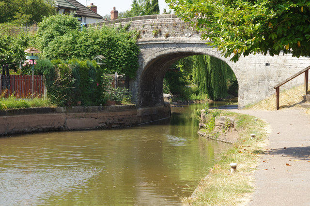
Image: © Stephen McKay Taken: 5 Jul 2018
The water level is very low here and this stretch of canal has been closed to navigation since a major breach near Stanthorne Lock in March 2018.
Images are licensed for reuse under creativecommons.org/licenses/by-sa/2.0
Image Location
Latitude
53.187475
Longitude
-2.443532