Bourton House
Introduction
The photograph on this page of Bourton House by Philip Halling as part of the Geograph project.
The Geograph project started in 2005 with the aim of publishing, organising and preserving representative images for every square kilometre of Great Britain, Ireland and the Isle of Man.

There are currently over 7.5m images from over 14,400 individuals and you can help contribute to the project by visiting https://www.geograph.org.uk
Bourton House
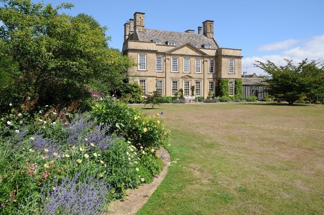
Image: © Philip Halling Taken: 3 Aug 2018
Bourton House viewed from the south. The house is early 18th century built on the foundations of an earlier late 16th century house. The house is Grade II* listed, see: https://historicengland.org.uk/listing/the-list/list-entry/1089559. The gardens are open to the public on some weekdays through the summer months.
Images are licensed for reuse under creativecommons.org/licenses/by-sa/2.0
Image Location


Leaflet Map data © OpenStreetMap
Latitude
51.990312
Longitude
-1.743209