Chapel Farm, Epperstone
Introduction
The photograph on this page of Chapel Farm, Epperstone by Neil Theasby as part of the Geograph project.
The Geograph project started in 2005 with the aim of publishing, organising and preserving representative images for every square kilometre of Great Britain, Ireland and the Isle of Man.

There are currently over 7.5m images from over 14,400 individuals and you can help contribute to the project by visiting https://www.geograph.org.uk
Chapel Farm, Epperstone
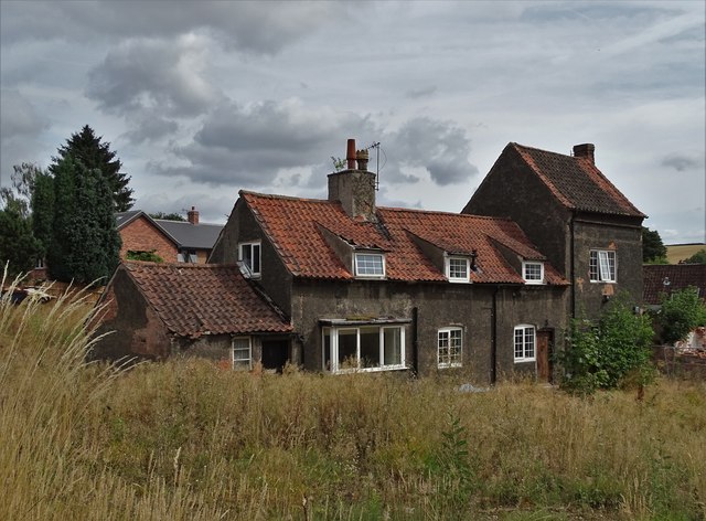
Image: © Neil Theasby Taken: 4 Aug 2018
Google aerial imagery of this part of the village of Epperstone is outdated. Most of this farm's buildings have been demolished and adjacent land has seen the development of a small, upmarket housing estate. Meantime the house itself is in a state of semi-dereliction.
Images are licensed for reuse under creativecommons.org/licenses/by-sa/2.0
Image Location
Latitude
53.031801
Longitude
-1.029516