Eastern end of the Erskine Bridge
Introduction
The photograph on this page of Eastern end of the Erskine Bridge by Richard Sutcliffe as part of the Geograph project.
The Geograph project started in 2005 with the aim of publishing, organising and preserving representative images for every square kilometre of Great Britain, Ireland and the Isle of Man.

There are currently over 7.5m images from over 14,400 individuals and you can help contribute to the project by visiting https://www.geograph.org.uk
Eastern end of the Erskine Bridge
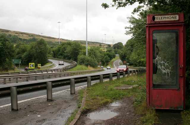
Image: © Richard Sutcliffe Taken: 29 Jul 2018
Approach to the Erskine Bridge on the A898 from the east. The telephone box is now only accessible to pedestrians. There used to be a small lay-by here, but it is no longer open, since a crash barrier was built across it.
Images are licensed for reuse under creativecommons.org/licenses/by-sa/2.0
Image Location
Latitude
55.923603
Longitude
-4.449821