Weltonfield Bridge east of Welton, Northamptonshire
Introduction
The photograph on this page of Weltonfield Bridge east of Welton, Northamptonshire by Roger D Kidd as part of the Geograph project.
The Geograph project started in 2005 with the aim of publishing, organising and preserving representative images for every square kilometre of Great Britain, Ireland and the Isle of Man.

There are currently over 7.5m images from over 14,400 individuals and you can help contribute to the project by visiting https://www.geograph.org.uk
Weltonfield Bridge east of Welton, Northamptonshire
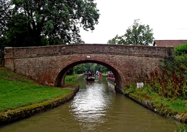
Image: © Roger D Kidd Taken: 22 Aug 2013
Weltonfield Bridge is No 2 across the Leicester Section of the Grand Union Canal. It was built as an accommodation bridge for Weltonfield Farm, and now also allows access to the boatyard and Welton Hythe Marina.
Images are licensed for reuse under creativecommons.org/licenses/by-sa/2.0
Image Location


Leaflet Map data © OpenStreetMap
Latitude
52.291473
Longitude
-1.121429