2007 : The Inner Ring Road (unfinished)
Introduction
The photograph on this page of 2007 : The Inner Ring Road (unfinished) by Maurice Pullin as part of the Geograph project.
The Geograph project started in 2005 with the aim of publishing, organising and preserving representative images for every square kilometre of Great Britain, Ireland and the Isle of Man.

There are currently over 7.5m images from over 14,400 individuals and you can help contribute to the project by visiting https://www.geograph.org.uk
2007 : The Inner Ring Road (unfinished)
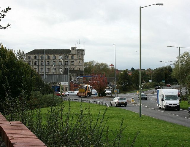
Image: © Maurice Pullin Taken: 16 Oct 2007
Trowbridge as a town was always functional rather than pretty, but it once had a certain charm. The uglification process began in the 1950's and is now well under way. This is the inner ring road, less than one third of it has been completed. Tesco's Super Store is off to the right and one of the old woollen mills is on the left.
Images are licensed for reuse under creativecommons.org/licenses/by-sa/2.0
Image Location
Latitude
51.318324
Longitude
-2.200983