Beach cleaning
Introduction
The photograph on this page of Beach cleaning by Duncan Graham as part of the Geograph project.
The Geograph project started in 2005 with the aim of publishing, organising and preserving representative images for every square kilometre of Great Britain, Ireland and the Isle of Man.

There are currently over 7.5m images from over 14,400 individuals and you can help contribute to the project by visiting https://www.geograph.org.uk
Beach cleaning
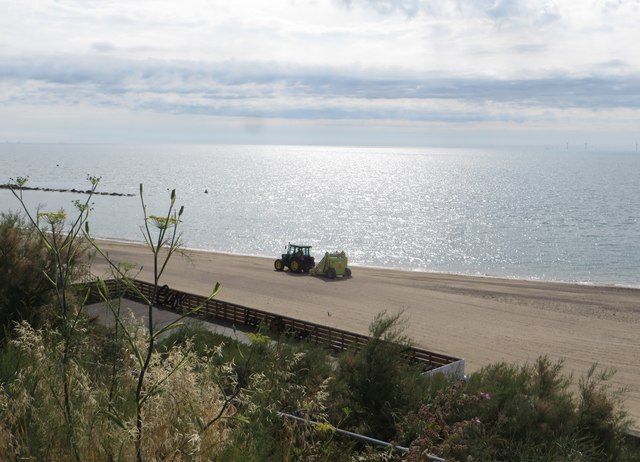
Image: © Duncan Graham Taken: 9 Jul 2018
Photograph of the beach being cleaned, taken from the upper promenade, with my back to Vista Road, at 9.25 a.m. BST. The machine pulled by the tractor sieves the sand before smoothing it. The roof of the Paddle Bay Diner (on the lower promenade) and the hand-rail of the path down the cliff are visible, along with the beach and sea beyond. One of the fish-tail groynes installed as part of sea defence work recently is just visible above the waves to the left. The blue and pink blur immediately above the diner's roof parapet is an ornamental wind-sock in the shape of a fish.
Images are licensed for reuse under creativecommons.org/licenses/by-sa/2.0
Image Location
Latitude
51.789911
Longitude
1.162363