The Village of Titley
Introduction
The photograph on this page of The Village of Titley by Fabian Musto as part of the Geograph project.
The Geograph project started in 2005 with the aim of publishing, organising and preserving representative images for every square kilometre of Great Britain, Ireland and the Isle of Man.

There are currently over 7.5m images from over 14,400 individuals and you can help contribute to the project by visiting https://www.geograph.org.uk
The Village of Titley
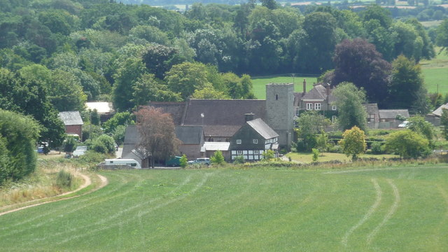
Image: © Fabian Musto Taken: 25 Jul 2018
A lot of familiar faces are seen here. St. Peter's Church is seen in the centre of this photo, the Vicarage is behind it on the right, and a farmhouse is in front of it. Viewed from a public footpath.
Images are licensed for reuse under creativecommons.org/licenses/by-sa/2.0
Image Location


Leaflet Map data © OpenStreetMap
Latitude
52.238301
Longitude
-2.985361