Coal tax boundary post no.100, Molesey Road / Pool Road
Introduction
The photograph on this page of Coal tax boundary post no.100, Molesey Road / Pool Road by Mike Quinn as part of the Geograph project.
The Geograph project started in 2005 with the aim of publishing, organising and preserving representative images for every square kilometre of Great Britain, Ireland and the Isle of Man.

There are currently over 7.5m images from over 14,400 individuals and you can help contribute to the project by visiting https://www.geograph.org.uk
Coal tax boundary post no.100, Molesey Road / Pool Road
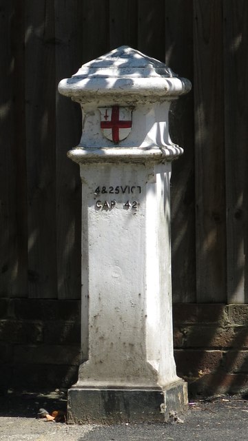
Image: © Mike Quinn Taken: 6 Jun 2018
The location of this post is shown in Image, Image and Image The post is Grade II listed https://historicengland.org.uk/listing/the-list/list-entry/1190896 . There are over 200 coal tax posts located around London, most of which are 3 ft high white-painted bollards http://www.geograph.org.uk/search.php?i=86542993&page=1 . The posts were erected under the Coal and Wine Duties (Continuation) Act of 1861 to mark the points at which duty had to be paid on coal being transported to London. The boundary was set at that of the Metropolitan Police District, and the resulting revenue was used by the Corporation of the City of London to fund public works. For further info see http://www.coaldutyposts.org.uk/cityposts.html .
Images are licensed for reuse under creativecommons.org/licenses/by-sa/2.0
Image Location


Leaflet Map data © OpenStreetMap
Latitude
51.395299
Longitude
-0.384064